📸 OFFICIAL VISUAL REPOSITORY • 4K INTERCEPT ARCHIVE

NMCP Field Media & Storm Archive

High-definition photography, atmospheric time-lapses, and 4K chase videography documenting supercell structures, tornadogenesis, and high-desert lightning across New Mexico and the Caprock.

Showing 9 items • Verified NMCP Raw Assets
📸 Sunset Storm Lea County, NM
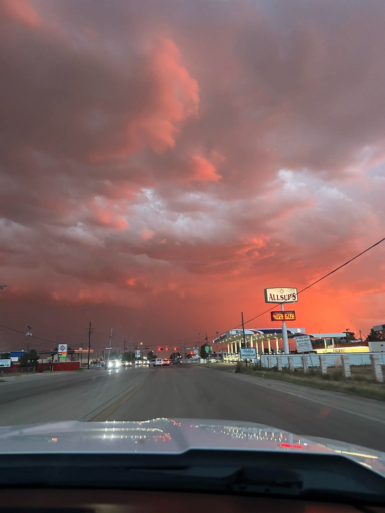
Hobbs Crimson Sunset Supercell Intercept
© NMCP ARCHIVE • PROPRIETARY
📍 Hobbs / Lea County, NM Frontline Intercept

Hobbs Crimson Sunset Supercell

Vibrant crimson and copper sunset illumination beneath a convective storm base and mammatus canopy rolling over Hobbs, NM.
👤 Dustin Garner 🔒 All Rights Reserved
⚡ Nocturnal Lightning Aerial / Elevated
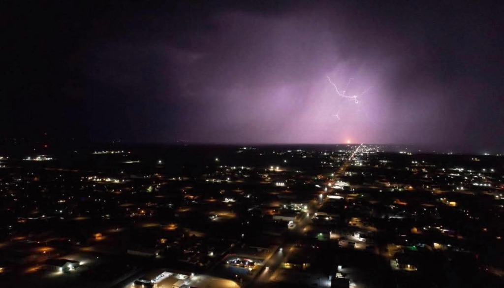
Hobbs Nocturnal Lightning Storm
© NMCP ARCHIVE • PROPRIETARY
📍 Hobbs / Lea County, NM Nocturnal Storm

Hobbs Nocturnal Lightning & City Grid

Elevated night perspective of Hobbs city lights beneath a massive nocturnal thunderstorm illuminating the anvil and spider lightning crawlers.

👤 Dustin Garner 🔒 All Rights Reserved
⚡ CG Lightning Direct Strike
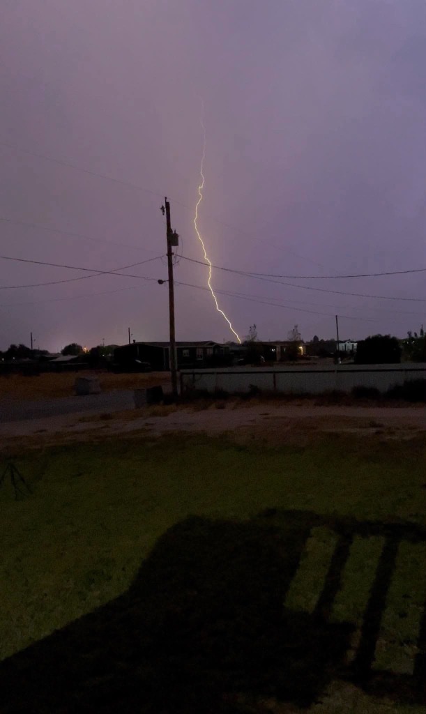
Hobbs Cloud-to-Ground Lightning Strike
© NMCP ARCHIVE • PROPRIETARY
📍 Hobbs / Lea County, NM Severe Discharge

Hobbs Vertical CG Lightning Bolt

Direct vertical cloud-to-ground lightning channel discharging with intense luminosity behind the utility corridor during a severe storm intercept in Hobbs.

👤 Dustin Garner 🔒 All Rights Reserved
☁️ Shelf Cloud Eddy County, NM
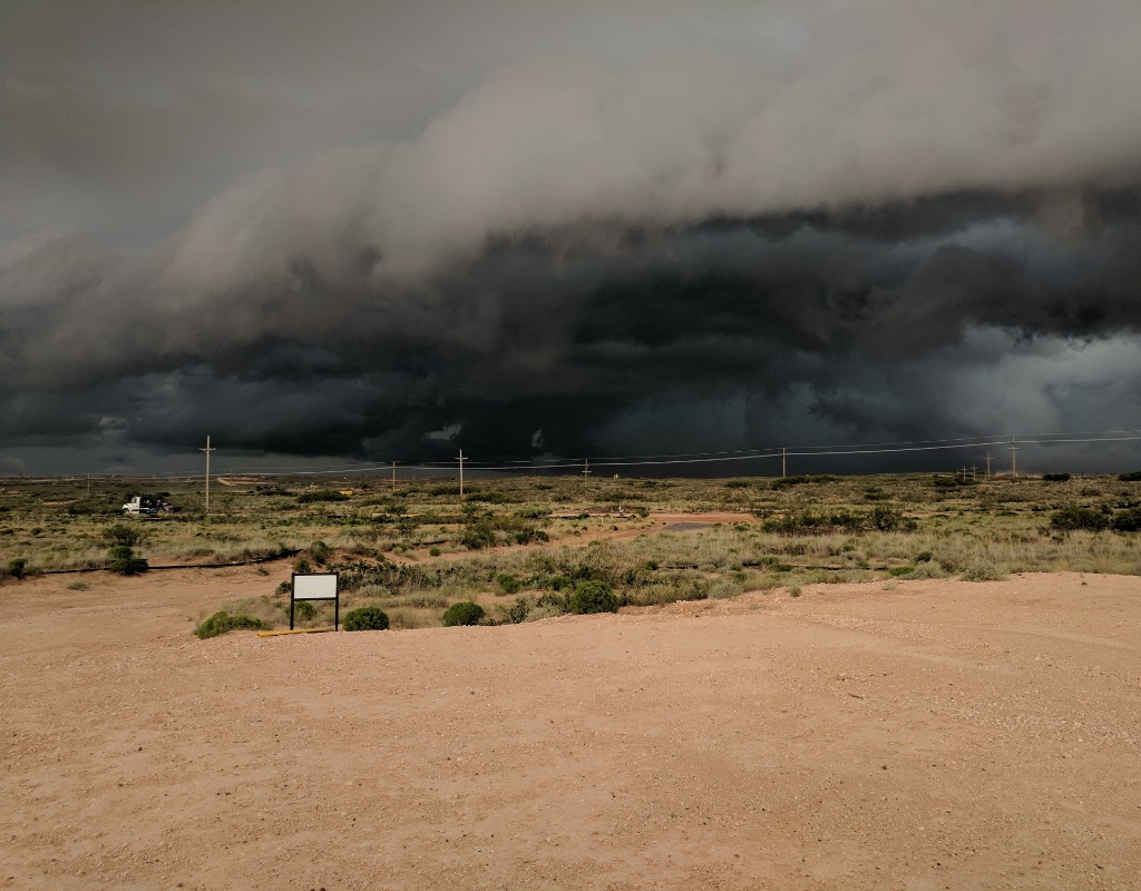
Loco Hills Severe Supercell Shelf Cloud
© NMCP ARCHIVE • PROPRIETARY
📍 Loco Hills / Eddy County, NM Severe Outflow

Loco Hills Severe Shelf Cloud

Massive dark, sculpted shelf cloud and outflow boundary advancing aggressively across the desert prairie outside Loco Hills along US-82.

👤 Dustin Garner 🔒 All Rights Reserved
🌪️ Wall Cloud Lea County, NM
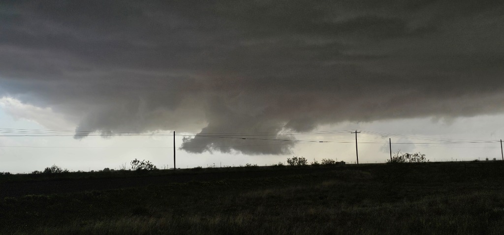
Buckeye Supercell Rotating Wall Cloud
© NMCP ARCHIVE • PROPRIETARY
📍 Buckeye / Lea County, NM Severe Wall Cloud

Buckeye Supercell Wall Cloud

Pronounced, persistent rotating wall cloud lowering beneath the dark rain-free storm base with ragged inflow scud tags near Buckeye, NM.

👤 Dustin Garner 🔒 All Rights Reserved
⚡ Lightning Lea County, NM
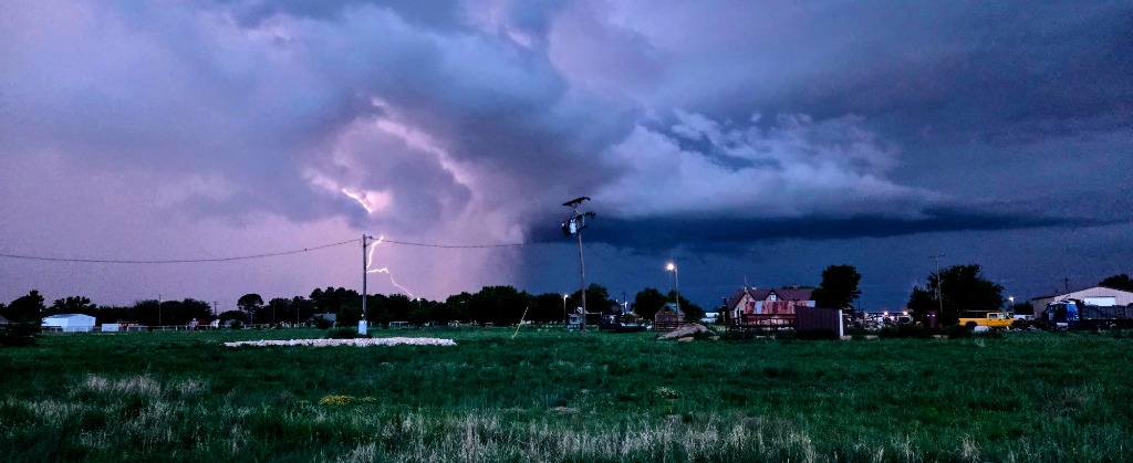
Lovington Convective Lightning Discharge
© NMCP ARCHIVE • PROPRIETARY
📍 Lovington / Lea County, NM Twilight Discharge

Lovington Convective Lightning Strike

Twilight convective storm cell illuminated from within by a sharp cloud-to-ground lightning discharge across the Lovington prairie.

👤 Dustin Garner 🔒 All Rights Reserved
🌪️ Supercell / Core Lea County, NM
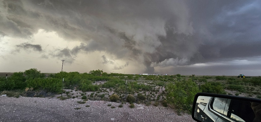
Buckeye Severe Supercell Hailcore & Downdraft
© NMCP ARCHIVE • PROPRIETARY
📍 Buckeye / Lea County, NM Severe Hailcore

Buckeye Severe Hailcore & Downdraft

Torrential hailcore and heavy precipitation downdraft descending from a severe supercell base, captured on intercept near Buckeye.

👤 Dustin Garner 🔒 All Rights Reserved

🎥 4K Field Chasing Video Highlights

High-frame-rate intercept captures, cockpit dashcam recordings, and drone cinematography.

🔴 NMCP YouTube Channel →
🔴 Channel ID: UCcDYPpHLQu3AITH33Knghaw Live • 1080p60

Live Field Intercept Feed • @newmexicostormchasing

Direct feed from the cockpit dashcam and rooftop 4K PTZ camera showing real-time positioning, Doppler radar cross-referencing, and severe storm intercepts.

👤 Lead Chaser Dustin Garner 🔒 Broadcast Rights Reserved
📍 Buckeye / Lea County, NM 1080p HD Intercept

Buckeye Landspout Vortex Intercept

Raw field intercept recording capturing active tornadic landspout vortex rotation and vertical column condensation over the prairie near Buckeye, NM.

👤 Dustin Garner 🔒 Broadcast Rights Reserved
High-Speed 240 FPS Lightning Strike
⚡ Video Slot 3 • media/video3.mp4
📍 Roswell / Chaves County, NM July 2026

240 FPS Nocturnal CG Stepped Leader Capture

High-speed phantom slow-motion recording capturing stepped leader propagation and massive return stroke illumination across the Pecos Valley.

👤 Dustin Garner 🔒 High-Speed RAW
📝 NMCP Media Licensing Request

Please complete this form to request commercial, broadcast, documentary, or editorial licensing permissions for NMCP photography or video footage.

Inquiries route directly to Dustin Garner (Project Director). Average response time: under 12 hours.